Nokia 6110 Navigator and Route 66 satellite navigation
Whilst we were on our recent holiday, we took the opportunity to try out the built-in Route 66 navigation software.
The main observations are as follows:
- The battery life with the navigation system running is obviously impacted. In Liverpool the phone ran out of battery a mile away from our accomodation. We bought an in-car charger for the unit to prevent this from happening at other times.
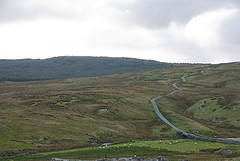
- The software likes direct routes. Despite having selected fastest rather than shortest it sent us through the Snowdonia mountain park, (the road in the photo), with cattle grids and gates etc. Even when I told the unit that I was in a lorry it sent me the same way.
- It is very optimistic about how long a journey will take. Unlike google maps' directions which I've found to be pretty accurate, at 100% Route 66 seems to expect 60 miles per hour on all road types, including that mountain pass.
- In city navigation is excellent, getting in and out of cities and towns using the navigation system was really good, and really helpful.
- The postcode to longitude/latitude conversion is problematic at times - I don't think this is the software's problem but a complication with low population areas. Something to be wary of - next time I'll check the position of the landmark on the map against any other map or information availabile
In summary, I'll probably still print out google maps, and I'll still have a road atlas in the car, but I'll also let Route 66 guide me in and out of cities and towns.
Cross posted to Jane and Richard's yak and natter.